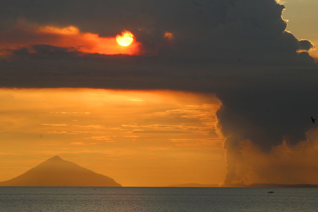
Indonesia's Mount Anak Krakatau, situated in the Sunda Strait between Sumatra and Java, produced a significant eruption on Tuesday, July 7, releasing a towering column of ash that reached approximately 100 metres above the crater. The event, recorded at 8:21 a.m. local time by the Geological Agency of the Energy and Mineral Resources (ESDM), represents the latest manifestation of an escalating volcanic episode that has intensified dramatically over the preceding month. The eruption ejected a dense gray plume that drifted north-westward from the crater, while seismic instruments documented a maximum amplitude of 11 millimetres with eruption duration of roughly 15 seconds.
The phenomenon marks a continuation of elevated activity that commenced on June 10 following an extended quiet period. The volcano has demonstrated a remarkable acceleration in unrest during the subsequent weeks. Between June 18 and 19 alone, monitoring stations recorded more than 50 seismic events daily, including eruption tremors and low-frequency earthquakes. This frequency intensified further between June 16 and July 2, when daily event counts averaged 97 occurrences, signalling a dramatic amplification of subsurface magmatic processes beneath the volcano.
Responding to this escalating threat, Indonesia's geological authorities took decisive action on Friday by elevating Mount Anak Krakatau's alert classification from Level II (Alert) to Level III (Watch), positioning it at the second-highest tier within Indonesia's four-category volcanic warning system. Concurrently, officials established a three-kilometre exclusion radius encompassing the volcano's crater zone, effectively prohibiting civilian access and activities throughout the designated area. Andi Suwardi, head of the Mount Anak Krakatau Observation Post in South Lampung, emphasised that despite the ongoing eruptions and fluctuating activity patterns, the volcano's alert status remained stable at the time of his statement, though 24-hour surveillance continues to monitor ash plume characteristics and seismic patterns.
The observation teams maintain constant vigilance, tracking multiple volcanic indicators to detect any sudden shifts that might necessitate further alert escalations. Suwardi cautioned that the public, fishermen, recreational climbers, and tourism operators must refrain from approaching the volcano or conducting any activities in surrounding waters and terrestrial zones until the Geological Agency modifies its safety recommendations. This appeal reflects legitimate concerns about potential hazards ranging from toxic gas emissions to sudden explosive activity or flank collapses that could trigger additional tsunamis affecting populated coastal regions.
Yet despite these explicit warnings and safety protocols, the economic pressures facing local communities have motivated some fishermen and tourism operators to continue venture into restricted waters, attempting to circumvent official monitoring systems. South Lampung Regent Radityo Egi Pratama acknowledged the genuine hardship experienced by communities whose livelihoods depend fundamentally on maritime activities and volcanic tourism. He recognised that heightened volcanic unrest has directly impaired local economic operations, yet insisted that safeguarding public welfare must supersede financial considerations until volcanic conditions normalise sufficiently to justify lowering the alert status.
Mount Anak Krakatau occupies a uniquely significant position within Southeast Asia's volcanic landscape and geological history. The volcano, whose name translates as "Child of Krakatau," emerged from the sea in 1927 within the massive caldera basin created by the catastrophic 1883 eruption of its parent volcano, Mount Krakatau. That 1883 event stands as one of recorded history's deadliest and most destructive volcanic disasters, generating powerful explosions and devastating tsunami waves that collectively claimed approximately 36,000 lives throughout the surrounding region. The eruption's effects extended globally, with atmospheric dispersion of volcanic ash and aerosols measurably affecting worldwide weather patterns and climate dynamics for months afterward.
The volcanic system's catastrophic potential became tragically evident again on December 22, 2018, when a partial collapse of Mount Anak Krakatau's flank destabilised the volcano's structure and triggered a major tsunami. The resulting waves inundated coastal regions across southern Sumatra and western Banten, killing at least 429 people and injuring more than 7,200 others. That disaster demonstrated conclusively that Mount Anak Krakatau, despite its considerably smaller size relative to its parent volcano, retains capacity to generate regional calamities affecting hundreds of thousands of inhabitants distributed across multiple provinces.
For Malaysian readers and Southeast Asian policymakers, this renewed volcanic crisis carries significant implications beyond Indonesia's borders. The Sunda Strait's geography means that large eruptions or flank collapses could generate tsunami waves reaching Malaysian waters, particularly affecting Peninsular Malaysia's western coast and Sabah-Sarawak's waters. Additionally, major volcanic eruptions in the region can inject sufficient ash and aerosols into the upper atmosphere to impact air quality across Southeast Asia, potentially affecting visibility and health conditions across a broad geographic footprint. Regional disaster preparedness frameworks require continuous upgrading to address transboundary volcanic hazards that transcend national boundaries.
The current situation underscores broader vulnerabilities facing Indonesia's densely populated regions surrounding active volcanic zones. The archipelago's position along the Pacific Ring of Fire exposes millions of residents to chronic volcanic and seismic hazards. Economic pressures frequently compel communities to inhabit or utilise zones designated as dangerous, creating persistent tension between survival imperatives and scientific safety recommendations. This scenario has played out repeatedly throughout Indonesia's volcanic regions, where exclusion zones struggle to maintain integrity when local populations perceive economic necessity overriding official restrictions.
Community engagement and transparent communication represent essential elements for effective volcanic hazard management. When authorities explain the mechanisms underlying volcanic dangers and demonstrate genuine consideration for economic rehabilitation during alert periods, compliance improves substantially. South Lampung's approach, acknowledging hardship whilst maintaining safety firmness, exemplifies this balance. However, translating such rhetoric into concrete livelihood support requires sustained governmental commitment and resources often unavailable during emergencies.
The technological infrastructure for monitoring Mount Anak Krakatau has expanded considerably since the devastating 2018 tsunami, providing Indonesian geologists with increasingly sophisticated real-time data regarding subsurface activity and eruption parameters. These monitoring systems enable rapid detection of dangerous escalations that warrant alert level modifications or expansion of exclusion zones. Yet technology alone cannot guarantee safety without complementary public compliance and accessible alternative livelihood opportunities for communities affected by access restrictions.
Moving forward, the challenge confronting Indonesian authorities involves maintaining heightened vigilance whilst working toward economic solutions that reduce incentives for dangerous zone entries. Early warning systems can provide precious minutes for evacuation when preceded by recognisable volcanic precursor signals, but prevention remains superior to emergency response. Regional cooperation mechanisms ensuring neighbouring countries receive timely volcanic hazard alerts will contribute toward broader Southeast Asian resilience to this persistent geological threat.

