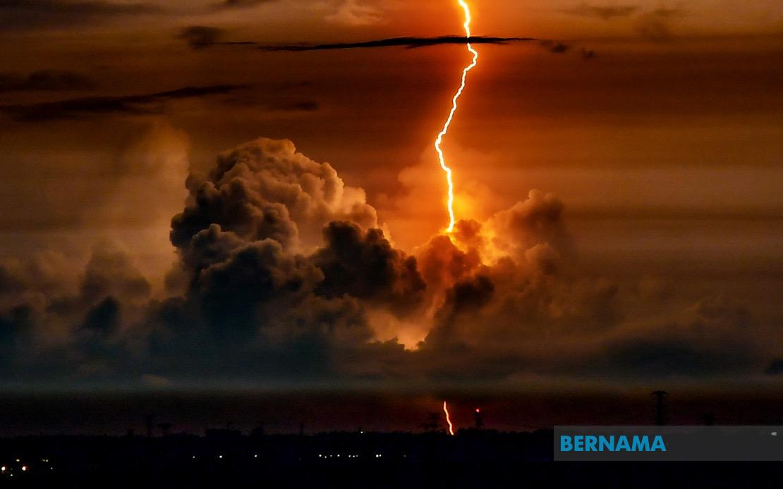
The Malaysian Meteorological Department has activated weather warnings across a substantial portion of the country, cautioning residents in 10 states and the federal territories of Kuala Lumpur, Putrajaya and Labuan to prepare for thunderstorms, torrential rainfall and gusty winds through the late afternoon. The alert underscores the unpredictable nature of Malaysia's monsoon season, during which weather patterns can shift rapidly and create localised hazards for motorists, commuters and residents in vulnerable areas.
The northern peninsula experiences some of the most severe impacts, with Perlis, Kedah, Penang and portions of Perak facing the full brunt of the system. In Perak, the affected districts include Kerian, Larut Matang, Selama, Manjung, Perak Tengah, Bagan Datuk, Hilir Perak, Muallim, Batang Padang, Kampar and Kinta, representing almost the entire state. These areas, particularly those in lower-lying zones and near river systems, face heightened risk of flash flooding when rainfall becomes intense over short periods.
Central Peninsular Malaysia is equally in the meteorological department's crosshairs. Pahang's vulnerability spans six districts: Bera, Rompin, Kuantan, Cameron Highlands, Maran and Pekan. The state's east coast location and terrain make it particularly susceptible to rapid water accumulation. Selangor, encompassing Malaysia's economic heartland, has seven districts under warning: Kuala Selangor, Klang, Kuala Langat, Petaling, Gombak, Sepang and Hulu Langat. These areas include critical infrastructure zones and densely populated urban centres, where congestion during severe weather can amplify transportation difficulties. Negeri Sembilan's Jempol and Jelebu districts round out the central region's alert zone, alongside Segamat in Johor.
East Malaysia faces comparable meteorological challenges. Sarawak's affected areas span multiple divisions reflecting the state's geographic diversity. Mukah, Miri, Bintulu, Sibu (including Selangau and Kanowit), Limbang, Kuching (encompassing Kuching and Bau), Sarikei's Julau and Kapit's Belaga all fall within the warning perimeter. These districts include both urban centres and rural communities, many reliant on river transport during flooding episodes. Sabah's Interior region, comprising Kuala Penyu, Beaufort, Membakut, Keningau, Tambunan, Tenom and Sipitang, shares similar vulnerabilities to Sarawak. The West Coast districts of Papar, Putatan, Penampang, Kota Kinabalu and Tuaran represent the state's population concentration, where infrastructure and economic activity face disruption from severe weather. Kinabatangan in Sandakan completes Sabah's alert area.
Thunderstorms of this magnitude pose multifaceted risks beyond simple rainfall. Lightning strikes present electrocution hazards, particularly in open areas and near elevated structures. Wind gusts accompanying severe convection can topple trees and damage roofing, dislodge signage and create airborne debris hazards. The combination of heavy precipitation and strong winds creates dangerous conditions on roadways, where visibility plummets and hydroplaning becomes a significant accident risk. Public transport networks, including bus services and rail systems, frequently experience delays or cancellations when weather deteriorates beyond safe operating parameters.
For Malaysian readers accustomed to tropical weather patterns, such warnings represent a critical window for preparatory action. Residents should secure loose outdoor items, monitor drainage systems and avoid unnecessary travel during peak storm activity. Motorists encountering flooded roads must resist the urge to drive through water, a deceptively dangerous behaviour that claims lives annually. Parents should exercise caution regarding children's outdoor activities, and those managing vulnerable populations ought to ensure adequate shelter and communication capabilities.
The extended geographic footprint of this weather system—spanning from Perlis in the far north through the peninsula's spine to both Sarawak and Sabah—demonstrates the scale and intensity of the atmospheric disturbance. Such broad-based alerts typically indicate a significant pressure system or convergence zone affecting the broader Malaysian region rather than isolated local phenomena. Understanding these meteorological patterns helps residents and emergency management authorities prepare more effectively for seasonal weather challenges.
Business continuity considerations should weigh heavily for organisations operating in the affected zones. Supply chain disruptions, staff attendance difficulties and potential facility damage warrant contingency planning. Government agencies and local authorities in the warned districts would typically activate emergency response protocols, pre-positioning resources and personnel to address flooding, road closures and public safety incidents. Coordination between federal and state-level authorities becomes essential when weather events span multiple jurisdictions simultaneously.
The five-o'clock evening deadline for the warning represents a standard meteorological alert window, after which conditions may stabilise or the system may progress beyond the affected areas. However, residents should remain vigilant even after official warnings expire, as secondary effects like localised flooding can persist longer than the primary thunderstorm activity. Checking updates from MetMalaysia through official channels ensures access to the most current meteorological intelligence as conditions evolve throughout the afternoon.

