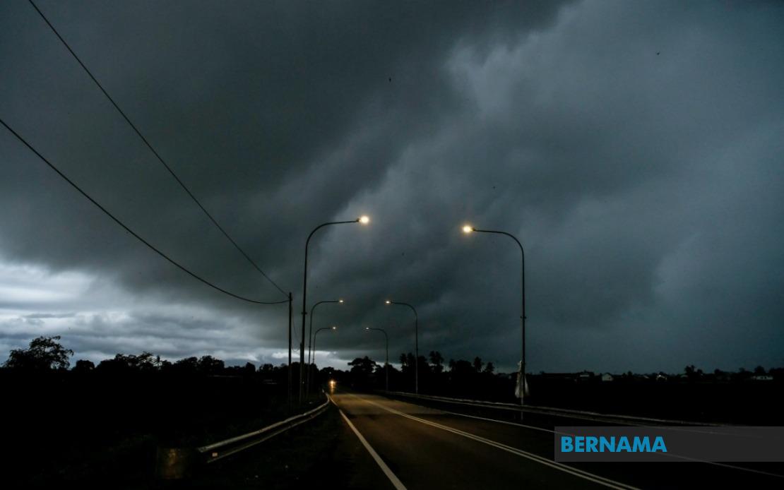
The Malaysian Meteorological Department has issued a thunderstorm warning extending across a substantial portion of the country, covering nine states alongside Kuala Lumpur and Putrajaya, with the alert remaining in effect until 6 pm. This widespread weather advisory reflects the heightened atmospheric instability expected across the peninsula and East Malaysia during the afternoon hours, prompting residents and commuters to exercise caution as weather systems develop and intensify.
On the peninsula, the Johor region faces the prospect of severe weather, alongside Negeri Sembilan, which sits strategically in the southern reaches of Selangor state. In Perak, seven districts have been flagged for potential thunderstorms, specifically Hulu Perak, Kuala Kangsar, Kinta, Kampar, Hilir Perak, Batang Padang and Muallim, covering zones from the central highlands down to the state's western lowlands. This geographical spread indicates that mountainous terrain and coastal plains alike may experience the forecasted conditions.
On the east coast, Kelantan's six identified districts—Tumpat, Pasir Mas, Jeli, Tanah Merah, Kuala Krai and Gua Musang—represent both the state's coastal and inland areas. Similarly, Terengganu's six districts including Setiu, Kuala Nerus, Kuala Terengganu, Marang, Dungun and Kemaman stretch from the shoreline to interior territories. These regions, which frequently experience moisture-laden winds during certain seasons, are particularly vulnerable to rapid weather deterioration when atmospheric conditions align.
Pahang, spanning from the mountainous Cameron Highlands through the Klang Valley plains, sees seven districts placed under alert: Tanah Tinggi Cameron, Bentong, Temerloh, Kuantan, Bera, Pekan and Rompin. The inclusion of tourist-dependent highland areas alongside lowland agricultural zones underscores the warning's broad geographic scope. In Selangor, seven districts have been identified—Sabak Bernam, Kuala Selangor, Hulu Selangor, Gombak, Petaling, Hulu Langat and Sepang—covering zones that collectively serve as Malaysia's most densely populated state and economic heartland.
The federal territories of Kuala Lumpur and Putrajaya, home to critical government and business infrastructure, are also within the warning zone. This inclusion is significant given the potential for flash flooding in urban areas with constrained drainage systems and the disruption such weather can cause to commerce, transport and daily operations. Commuters should anticipate possible traffic delays and transit disruptions as visibility diminishes and road surfaces become hazardous.
East Malaysia faces similarly widespread conditions. In Sarawak, the warning encompasses Kuching, the state capital and largest urban center, alongside eight other administrative divisions: Sarikei's Julau district, Sibu's Kanowit district, Mukah district proper, Kapit's Song district, Bintulu district and Sebauh, and Miri divisions including Subis, Beluru, Miri and Marudi, plus Limbang. This coverage spans from the densely populated southwestern zone through to the sparsely settled northern territories bordering Brunei.
Sabah's warning zones are similarly extensive, divided into three geographic clusters. The Interior division includes Sipitang, Tenom, Beaufort, Nabawan, Keningau and Tambunan, representing the state's highland and rural heartland. The West Coast cluster—Papar, Penampang, Kota Kinabalu, Tuaran and Ranau—encompasses Sabah's major population centers and economic zones, including the state capital. Sandakan division is alerted for four districts: Tongod, Telupid, Beluran and Sandakan itself, covering the state's northeastern sector.
The simultaneous issuance of alerts across such geographically diverse and climatically distinct regions suggests a particularly unstable atmospheric pattern expected to persist through the afternoon. Thunderstorms of this scale typically develop when warm, moist air encounters cooler upper atmosphere layers or when converging wind patterns create uplift zones. Heavy rainfall accompanying such systems poses flooding risks, particularly in low-lying areas, while strong wind gusts can cause structural damage and disrupt utilities.
Residents and businesses across the affected regions are advised to secure loose outdoor items, avoid unnecessary outdoor activities during the warning period, and stay informed through official meteorological updates. Motorists should reduce speed and increase following distances, whilst those in flood-prone areas should prepare evacuation plans. The six-hour window provides adequate time for preparatory measures before conditions are expected to improve.
For Malaysian readers, particularly those in the Klang Valley and surrounding high-density areas, such widespread simultaneous warnings remain relatively uncommon, making this an appropriate occasion for heightened awareness. The inclusion of major urban centers means significant proportions of the nation's population may experience or be affected by these conditions, warranting attention to official guidance from the Malaysian Meteorological Department and relevant state authorities.

