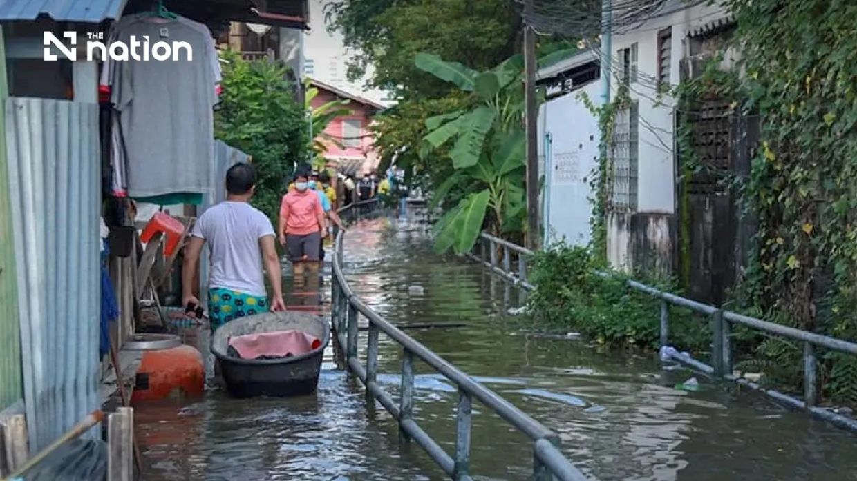
Thailand's Department of Disaster Prevention and Mitigation has activated a week-long alert covering Bangkok and six adjacent central provinces after the Royal Thai Navy's Hydrographic Department flagged elevated sea levels expected to peak between 6pm and 10pm nightly from Monday, July 13, through Sunday, July 19. The warning encompasses Pathum Thani, Nonthaburi, Nakhon Pathom, Samut Sakhon, Samut Songkhram, and Samut Prakan, reflecting growing concerns about tidal surge impacts along Thailand's vital Chao Phraya River system and its tributary network.
Theerapat Kachamat, the DDPM's director-general, announced the precautionary measures at midday on Saturday, July 11, after coordinating with naval hydrographic specialists monitoring water conditions at key reference points including Phra Chulachomklao Fort in the estuary. The advisory signals heightened vigilance during a critical period when the combination of elevated sea levels and normal daily tidal fluctuations could breach river defences and inundate vulnerable low-lying neighbourhoods where flood barriers remain incomplete or absent altogether.
The flooding threat extends beyond the main Chao Phraya channel to secondary waterways and canal networks that crisscross the central region, where informal settlements and agricultural lands lie particularly exposed. Communities situated outside permanent flood infrastructure or in areas dependent on temporary embankments face the greatest risk during the forecast window. The warning acknowledges that while high-tide cycles are seasonal phenomena in this delta region, cumulative stress from multiple consecutive nights of elevated water levels can overwhelm localised drainage capacity and saturate soil barriers protecting adjacent developments.
Specific districts flagged for heightened monitoring include Mueang Pathum Thani and Sam Khok in Pathum Thani Province; Mueang Nonthaburi, Pak Kret, and Bang Kruai in Nonthaburi; Bang Len, Nakhon Chai Si, and Sam Phran in Nakhon Pathom; all districts across Samut Songkhram; and Mueang Samut Prakan, Phra Samut Chedi, Phra Pradaeng, and Bang Bo in Samut Prakan. These enumerated zones represent areas where DDPM analysts expect the most acute vulnerability based on topographical data and historical flood records.
Provincial authorities have received explicit instructions to disseminate public awareness campaigns targeting both permanent residents and business operators whose livelihoods depend on riverside locations. This includes owners of floating restaurants, water-transport services, and riverbank construction enterprises currently engaged in embankment fortification projects that themselves become vulnerable during heightened tidal conditions. The messaging emphasises continuous situational awareness throughout each evening's peak tidal window, enabling rapid evacuation or protective measures if water levels breach predicted thresholds.
The Central Disaster Prevention and Mitigation Command has coordinated this multi-province response through the DDPM hierarchy, establishing a unified operational framework to streamline communications across administrative boundaries. This coordination structure proves essential in the Chao Phraya delta, where water flows across provincial demarcations and upstream decisions in one jurisdiction directly influence downstream conditions elsewhere. The command's activation reflects lessons learned from previous tidal flood episodes that exposed coordination gaps between provincial agencies operating in isolation.
From a Southeast Asian perspective, this alert underscores the region's ongoing vulnerability to water-level fluctuations driven by both natural tidal cycles and longer-term climatic trends affecting the Gulf of Thailand. Land subsidence in the Bangkok metropolitan area—partly attributable to historical groundwater extraction—has compounded natural tidal threats by lowering critical flood-defence elevations relative to mean sea level. Thailand's experience resonates across Indonesia, Vietnam, and Cambodia, where comparable river deltas and coastal cities face similar compound hazards from tidal surge, inadequate infrastructure, and sinking terrain.
Public notification channels have been centralised through the THAI DISASTER ALERT mobile application, ensuring that affected residents and business operators can receive real-time updates and detailed high-tide timing information without relying solely on traditional broadcast media. This digital-first approach reflects Thailand's evolving disaster communication strategy, though the DDPM has maintained legacy reporting mechanisms including the 1784 hotline for affected residents seeking immediate assistance or needing to report damage and coordinate rescue response.
The warning period's concentration during evening hours—6pm to 10pm—suggests that tidal dynamics in this stretch of the estuary peak during specific phase relationships between lunar cycles and diurnal tidal constituents. This predictability allows provincial officials to pre-position response teams and stage resources during daylight hours, positioning pumping equipment and sandbag supplies at known high-risk locations before water levels rise. The week-long duration, rather than a single-night alert, indicates that meteorological conditions or astronomical tidal factors are expected to sustain elevated levels across multiple consecutive cycles rather than producing an isolated spike.
For Malaysian observers, Thailand's precautionary alert framework offers instructive comparison with Malaysia's own flood-warning systems. While Peninsular Malaysia's monsoon-driven flooding patterns differ markedly from the tidally-influenced inundation affecting Thai river deltas, coastal communities in Selangor, Negeri Sembilan, and northern Johor face analogous compound-hazard scenarios where multiple water-source pathways converge to overwhelm local drainage infrastructure. Thailand's emphasis on early, specific geographic targeting and coordinated multi-agency mobilisation represents a management model that Malaysian state and federal authorities increasingly reference when designing flood-response protocols for densely populated river-delta regions.
The DDPM's reliance on Royal Thai Navy hydrographic data demonstrates how maritime technical expertise informs flood forecasting in regions where river and sea water interact dynamically. This institutional arrangement differs from Malaysian practice, where weather and hydrological forecasting responsibilities remain primarily distributed among the Malaysian Meteorological Department and the Department of Irrigation and Drainage. Thailand's approach consolidates naval oceanographic resources into civilian disaster-planning operations, reflecting recognition that tidal and coastal hydrodynamic expertise constitutes specialised knowledge essential for delta-region flood management.
As climate change continues altering precipitation patterns and mean sea levels across Southeast Asia, recurring alerts like this Bangkok-centred warning may intensify in frequency and geographic scope. Authorities across the region are recognising that traditional infrastructure designs—premised on historical hydrological baselines—increasingly prove inadequate for current conditions. Thailand's rolling weekly alerts for tidal hazards, increasingly complemented by climate-scenario-based long-term planning, exemplify the adaptive management mindset now necessary across all Southeast Asian low-lying population centres seeking to maintain economic activity and habitability amid rising environmental pressures.

