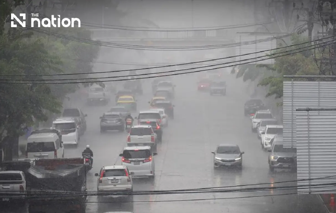
Thailand's weather forecasters are sounding the alarm over an escalating flood threat affecting much of the country, with the greatest danger concentrated in mountainous northern terrain and the low-lying northeast plateau. The Thai Meteorological Department released its ninth consecutive warning on Wednesday afternoon, cautioning that a convergence of two major weather systems—a monsoon trough sweeping across upper Thailand and a reinforced southwest monsoon over the Andaman Sea and Gulf—will drive relentless rainfall through Friday. Authorities are particularly concerned about the compounding effect of accumulated moisture, which transforms routine thunderstorms into hazardous flash-flood events, especially where terrain funnels water rapidly downslope toward populated foothill villages and riverside communities.
The warning carries immediate practical implications for millions of Thais in vulnerable zones. Residents in foothill settlements, floodplain communities, and areas adjacent to natural drainage channels face the most acute risk. The department specifically flagged low-lying neighborhoods where water can rise suddenly and unexpectedly, sometimes within hours of heavy downpours beginning. This risk profile is particularly acute in Thailand's north, where steep topography and ancient waterway systems concentrate runoff into narrow valleys. Motorists have been advised to avoid routes with established flooding histories, a directive that carries serious consequences for commerce, school attendance, and medical access in regions where alternative roads may not exist or require lengthy detours.
Northern Thailand will experience the most severe weather intensity, with thunderstorms developing across eighty percent of the region from Wednesday evening through Thursday. Seven provinces face the specific threat of very heavy rain: Mae Hong Son, Lampang, Nan, Phrae, Uttaradit, Phitsanulok, and Phetchabun. These areas will be interspersed with additional provinces—Chiang Mai, Chiang Rai, Phayao, Lamphun, Sukhothai, Tak, Kamphaeng Phet, and Phichit—where heavy rainfall is forecast. The combination exposes a huge swathe of Thailand's tourist and agricultural heartland to disruption. Provincial capitals and major towns in these regions typically lack adequate drainage infrastructure to handle the volume of water these systems can deliver, and rural areas remain almost entirely defenseless against flash floods.
The northeastern region faces similarly widespread storm coverage, with thunderstorms probable over eighty percent of the territory. A dozen provinces will experience heavy rain, including major centers such as Nakhon Ratchasima, which serves as the economic hub of the northeastern plateau. Eight additional provinces—Loei, Nong Khai, Bueng Kan, Udon Thani, Sakon Nakhon, Nakhon Phanom, Kalasin, and Mukdahan—will face very heavy downpours. This pattern matters significantly for Southeast Asia's broader economic picture, as the northeast supplies agricultural products and manufactures goods destined for export markets across the region. Road disruptions and flooding damage to crops or infrastructure can ripple outward, affecting supply chains that extend well beyond Thailand's borders.
The meteorological dynamics driving these conditions involve a textbook monsoon scenario that becomes hazardous when multiple systems align. The southwest monsoon, which typically brings seasonal rains to Thailand from May through October, has strengthened considerably over the maritime regions. Simultaneously, a monsoon trough—a band of low pressure that triggers convective development—is positioned squarely over upper Thailand. These systems interact to create stationary thunderstorm complexes that can dump enormous rainfall volumes on the same locations for extended periods. Historical data shows that such configurations have preceded some of Thailand's worst flood disasters, making the convergence of current atmospheric conditions genuinely concerning to meteorologists.
Central Thailand and the eastern region, while facing somewhat lower probabilities, are not exempt from danger. The Central region will see thunderstorms across sixty percent of its area, with heavy rain threatening provinces including Nakhon Sawan, Phra Nakhon Si Ayutthaya, Lop Buri, Saraburi, Kanchanaburi, and Ratchaburi. The eastern provinces face seventy percent storm coverage, with Trat province specifically flagged for potential very heavy rain. Bangkok and its surrounding provinces will experience isolated heavy thunderstorms affecting sixty percent of the metropolitan area, which could amplify flooding in the capital's notoriously congested drainage system and low-lying eastern suburbs.
Maritime hazards form a secondary but serious component of the forecast. Waves across the upper Andaman Sea and upper Gulf of Thailand will reach two to three meters in normal conditions, exceeding three meters during thunderstorms. These conditions render small boats unseaworthy and dangerous, prompting authorities to order small craft ashore through Friday. The directive affects commercial fishing communities, tour operators, and maritime transport networks that depend on these waters. Larger vessels transiting the region must proceed under extreme caution, as rapidly developing thunderstorms can create sudden, violent sea states that prove hazardous even to substantial ships. The lower Andaman Sea will experience somewhat calmer conditions, with approximately two-meter waves in non-stormy periods, but even these heights exceed safe operating parameters for smaller commercial operations.
The forecast extends southward along Thailand's peninsula coasts as well. The eastern coast of the South, encompassing Phetchaburi, Prachuap Khiri Khan, Chumphon, and Surat Thani, faces a forty percent probability of thunderstorms concentrated in these provinces. Wave heights of two to three meters will predominate, with waves exceeding two meters offshore and during storms. The southern extremity from Nakhon Si Thammarat downward will experience somewhat lighter conditions, though waves will still reach one to two meters offshore with significant storm-driven increases. This geographic spread of hazardous conditions underscores that the weather pattern is regional in scope rather than localized, affecting Thailand's entire maritime zone and coastal population simultaneously.
Temperature and wind patterns accompanying the rainfall will create additional hazards. Overnight lows across most of Thailand will remain in the comfortable range of 22 to 27 degrees Celsius, while daytime highs will hover between 28 and 36 degrees Celsius depending on region. However, southwesterly wind speeds will vary considerably, reaching 10 to 20 kilometers per hour in inland areas but accelerating to 20 to 40 kilometers per hour in eastern regions and maritime zones. These moderate-to-fresh winds, combined with heavy rainfall and rough seas, will substantially complicate rescue operations and evacuation efforts should flooding occur, as boat traffic becomes dangerous and visibility deteriorates during storms.
The practical advice issued by the Thai Meteorological Department reflects hard-won lessons from previous flooding disasters. Residents are instructed to monitor official forecasts continuously, avoid travel during peak rainfall hours, stockpile emergency supplies, and position themselves on higher ground in communities with established flood vulnerability. The emphasis on "accumulated rainfall" acknowledges that total precipitation from multiple consecutive storm days poses greater risk than any single day's rainfall, a crucial distinction often overlooked by casual weather observers. Communities with history of flash-flooding—predominantly in hilly terrain where water concentration is inevitable—should activate pre-positioned evacuation plans and warn residents to expect rapid water level rises.
For Malaysia and other Southeast Asian nations, Thailand's weather situation carries indirect implications. Regional supply chains often depend on Thai agricultural products, manufactured goods, and transport connections. Significant flooding could disrupt shipments and delay deliveries throughout the region. Additionally, cross-border communities and shared watershed areas mean that Thai flooding can influence water levels affecting neighboring territories. Malaysian environmental and disaster management authorities monitor Thai weather patterns closely, particularly during monsoon season when weather systems frequently traverse national boundaries. The intensity of the current forecast suggests that monsoon moisture will remain abundant across mainland Southeast Asia through the week, potentially triggering similar flood risks in Malaysian border regions and downstream areas.
Authorities across the affected Thai regions have been mobilizing emergency response assets in anticipation of the forecast conditions. Provincial disaster management offices are coordinating with local government units, emergency services, and community organizations to ensure rapid response capability should flooding develop. The three-day warning window provides sufficient time for most communities to implement preparedness measures, though the speed at which flash floods develop in hilly terrain means that residents must remain vigilant and responsive. The forecast underscores the ongoing vulnerability of rapidly urbanizing Southeast Asian societies to extreme weather events, particularly in regions where drainage infrastructure lags behind development.

