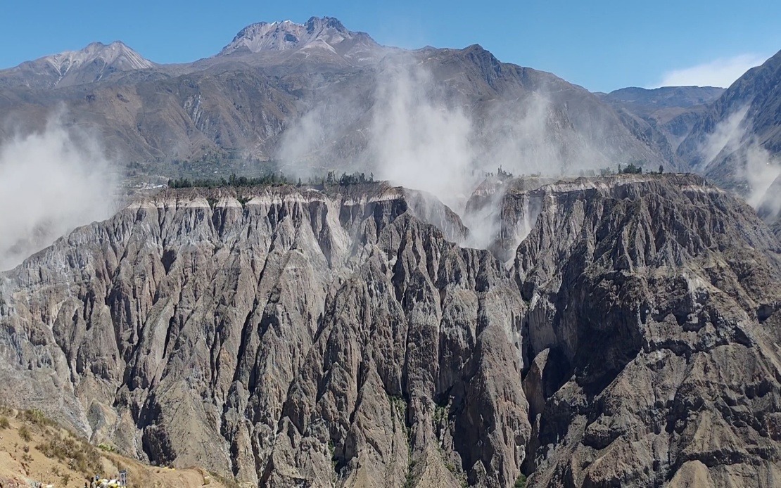
A significant 6.7-magnitude earthquake jolted southern Peru on Thursday afternoon, sending tremors across the nation and raising alerts among emergency management officials across the country. The US Geological Survey confirmed the seismic event, while Peru's own Geophysical Institute (IGP) registered the tremor at a slightly higher magnitude of 7.2, recording the incident at approximately 1 pm local time. The epicentre was pinpointed roughly 35 kilometres north of Coracora, situated within Parinacochas province in Ayacucho department, a region in Peru's southern highlands.
What potentially saved the region from extensive damage was the quake's depth of 108 kilometres beneath the earth's surface. Geophysicists explained that this intermediate depth absorbed considerable seismic energy before it reached populated areas, substantially diminishing its destructive potential. The resulting ground shaking registered only III-IV on the Mercalli intensity scale—classified as light to moderate trembling—meaning residents experienced noticeable movement without the violent jolting associated with shallow, high-magnitude earthquakes. This protective depth factor proved crucial in preventing the kind of infrastructure collapse and mass casualties that shallower earthquakes often produce.
Despite the earthquake's considerable magnitude, Peruvian disaster management agencies reported no immediate loss of life or serious structural damage following preliminary assessments. The absence of reported casualties in such a heavily populated region stands as testimony to modern building codes and construction practices implemented following previous seismic disasters. Authorities conducted rapid surveys across affected zones to verify conditions and continued monitoring throughout the afternoon and into the evening. Confirmation of safety came relatively quickly, allowing residents to resume normal activities after the initial shock and verification phases.
The tremor reverberated through a substantial geographic area, with residents reporting noticeable shaking across southern and central Peru. Lima, the capital city located hundreds of kilometres away on the coast, registered perceptible movement, demonstrating the earthquake's far-reaching energy release. Multiple regions activated emergency protocols and conducted damage assessments following the event, though these revealed no significant structural compromises or infrastructure failures. The widespread sensation across the country underscored the earthquake's genuine power, even if its depth prevented catastrophic surface effects.
This seismic event arrives during a period of elevated earthquake activity affecting both Peru's northern and southern regions. The pattern reflects the country's location along the Pacific Ring of Fire, an active seismic zone encircling the Pacific Ocean where approximately 90 percent of the world's earthquakes occur. Peru's position along the boundary between the South American and Nazca tectonic plates ensures a constant threat of seismic activity. Scientists monitor these regions intensively, studying patterns that might indicate future significant events and working to improve early-warning systems.
The country's recent seismic history provides sobering context for current vigilance efforts. In 2007, a devastating 7.9-magnitude earthquake struck the Ica region, causing nearly 600 deaths and extensive destruction across southern Peru. That catastrophe prompted comprehensive reevaluation of building standards, emergency response protocols, and public awareness campaigns. The lessons learned from 2007 have shaped how modern Peru approaches earthquake preparedness and response, influencing everything from construction codes to evacuation procedures and emergency supplies stockpiling.
In response to Thursday's earthquake and the broader pattern of recent seismic activity, Peru's Geophysical Institute and the National Seismological Centre (CENSIS) issued formal recommendations for sustained public vigilance. Officials urged residents throughout the country to review household evacuation protocols, ensuring family members understand where to go and how to communicate during emergencies. The IGP also emphasized the importance of maintaining readily accessible emergency supply kits containing essentials such as water, non-perishable food, first-aid materials, and battery-powered communication devices. These preparedness measures represent fundamental elements of earthquake risk reduction in a seismically active nation.
For Malaysian and Southeast Asian observers, Peru's earthquake experience offers relevant lessons regarding disaster preparedness in tectonically active regions. While Malaysia sits in a relatively stable seismic zone, neighbouring regions including Indonesia, the Philippines, and Thailand face significant earthquake risks. Peru's approach to building resilience—combining stringent construction standards, public education, regular emergency drills, and maintaining family preparedness plans—provides a model for regional risk management. The success of Peru's response to Thursday's earthquake, measured by the absence of casualties despite substantial seismic energy release, demonstrates how systematic preparation and infrastructure investment can substantially mitigate natural disaster impacts.
The event also highlights how international scientific collaboration strengthens earthquake understanding and response. The coordination between Peru's domestic agencies, the US Geological Survey, and international seismological networks enables rapid information sharing and consistent magnitude reporting. This global scientific cooperation assists all earthquake-prone nations in understanding local seismic patterns and improving prediction and warning capabilities. As climate change potentially influences Earth's stress patterns, continued investment in seismic monitoring networks and international scientific exchange becomes increasingly valuable for all affected regions.
Moving forward, Peruvian authorities will continue enhanced monitoring of seismic activity across the southern and northern zones where recent tremors have concentrated. Scientists will analyse Thursday's earthquake data to refine understanding of the region's tectonic processes and potentially improve forecasting capabilities. The incident serves as an important reminder that in geologically active regions, earthquake preparedness must remain a consistent national priority, encompassing education, infrastructure investment, and maintaining public readiness for inevitable future seismic events.

