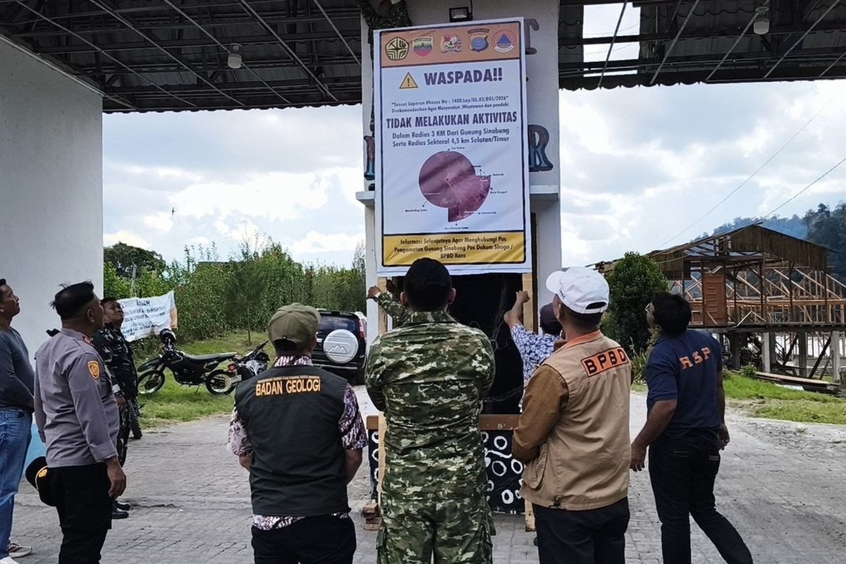
Authorities in Indonesia's Karo regency have moved swiftly to restrict public access to popular tourist destinations surrounding Mount Sinabung following a marked uptick in volcanic activity over recent days. Starting from August 19, the administration has shuttered Lau Kawar Lake and an adjoining camping facility in Kuta Gugung village, Naman Teran district, with no predetermined timeline for reopening. The decision reflects growing concern among officials that the volcano's behaviour warrants enhanced protective measures for both residents and visitors to the region.
The protective measures were implemented based on direct guidance from Indonesia's Vulcanology and Geological Disaster Mitigation Center's dedicated monitoring post at Mount Sinabung. Juni Antomi Kemit, head of the Karo Youth Affairs, Sports and Tourism Agency, characterised the temporary closure as a necessary precaution given the volcano's escalating restlessness. By late August, officials had confirmed that the closure would persist pending further assessment of conditions at the summit. The decision also built upon a public advisory issued by the Karo regent on August 14 that explicitly discouraged all outdoor activities, recreation, and climbing expeditions in areas surrounding the volcano.
The formal escalation of Mount Sinabung's alert status marks a significant shift in the government's assessment of risk. Armen Putra, the monitoring post's commanding officer, disclosed that the alert level had been elevated from Level I Normal to Level II Waspada, which translates to an advisory alert in Indonesia's four-tier warning framework. This classification signals that while the volcano is not yet in an imminent danger phase, conditions warrant heightened vigilance and precautionary measures. Officials subsequently established exclusion zones to guide safe behaviour: a three-kilometre radius around the summit and an extended 4.5-kilometre protective perimeter extending toward the south-east sector are now off-limits for civilian activity.
Scientific data from the monitoring station paints a picture of intensifying volcanic processes beneath Mount Sinabung's surface. The volcano has been producing frequent tremors with variable intensity, accompanied by visible volcanic gas emissions reaching heights of 100 to 800 metres above the crater. On the morning of August 27, monitoring equipment recorded five distinct volcanic earthquakes alongside additional tectonic seismic activity—a notably higher frequency than the previous day's count of one volcanic quake and seven tectonic events. Armen cautioned that the escalating earthquake activity correlates directly with increased volcanic potential, suggesting the system is moving toward a more energetic state.
Residents living along river valleys that originate on the volcano's slopes face particular vulnerability to secondary hazards. Officials have specifically warned communities in these areas to maintain heightened awareness regarding the risk of sudden mud flows, which can be triggered by small explosions, pyroclastic activity, or rainfall interacting with loose volcanic material accumulated from previous eruptions. The alert recommendations were formally issued on August 13, providing advance notice to vulnerable populations in the region.
Mount Sinabung's eruptive history reveals a volcano that operates on extended cycles of dormancy punctuated by energetic activity periods. The 2,460-metre peak lay quiet for approximately four centuries before its dramatic return to activity on August 29, 2010, following a long repose. This initial eruption proved relatively modest, with activity subsiding by September of that year. The volcano subsequently entered a more volatile phase, erupting again on September 15, 2013, a pattern that escalated dramatically when a major eruption struck in November 2013.
The November 2013 eruption represented a watershed moment for communities surrounding Mount Sinabung, bringing the alert status to the maximum Level IV Awas category. The explosive event generated deadly pyroclastic flows—superheated avalanches of gas and volcanic material that descended the volcano's flanks at tremendous speed. Dozens of people perished in the immediate vicinity, while approximately 21 villages and two hamlets were evacuated, displacing thousands of residents. The economic and social disruption extended across multiple months as the volcano maintained its active phase.
Following the 2013 eruptions, Mount Sinabung sustained continuous volcanic output for six consecutive years, keeping the region under sustained alert and disrupting tourism and daily life. This prolonged activity period eventually showed signs of diminishing intensity, leading officials to lower the alert status to Level III Siaga in May 2019 following careful analysis of both visual and instrumental monitoring data. The downgrade suggested that the immediate threat had lessened, allowing communities to gradually return toward more normal activities, though full recovery remained incomplete.
The volcano demonstrated that its dormancy period had definitively ended when it erupted once more on July 28, 2021, in what would become the most recent major eruption to date. This event expelled ash columns reaching 4,500 metres into the atmosphere while directing pyroclastic flows eastward and southeastward across distances of approximately one kilometre from the summit. The eruption's atmospheric impact was substantial, with five districts experiencing significant ashfall. The 2021 event concluded an 11-year period of active volcanism that had fundamentally altered the region's relationship with this geographic feature, transforming Mount Sinabung from a dormant landmark into an active hazard requiring constant monitoring and adaptive management.
For Malaysian observers, Mount Sinabung's recent escalation underscores how volcanic risks in Southeast Asia demand sophisticated institutional responses and coordinated public communication strategies. The Indonesian government's decision to preemptively close tourism facilities rather than wait for a catastrophic event represents risk management best practice. The incident also highlights the broader challenge facing island nations throughout the region, where geological hazards intersect with economic pressures tied to tourism revenue. Communities and governments must continually balance legitimate safety imperatives against the development needs of vulnerable populations who often depend on tourism income for survival, a tension that remains unresolved across much of the archipelago.

