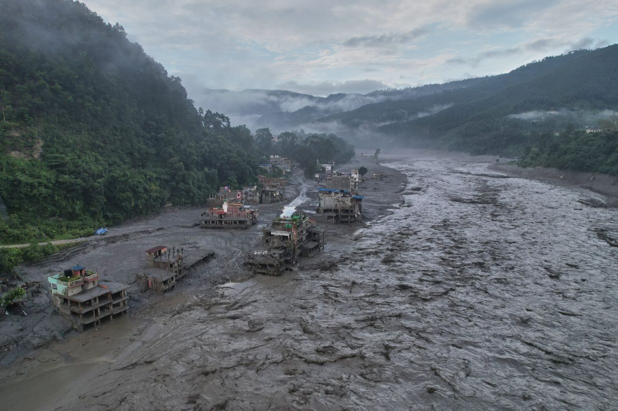
The speed at which disaster struck Nepal's mountain valleys last week underscores a sobering reality: residents had mere minutes to escape before torrential waters obliterated everything in their path. Officials now acknowledge that this razor-thin window of warning reflects systemic weaknesses in monitoring infrastructure that leave the Himalayan region dangerously exposed to emerging climate-related hazards. The catastrophe, which claimed at least 800 lives and left more than 3,000 people unaccounted for, has become a stark reminder of how geographical isolation and inadequate international cooperation can compound natural disasters into civilisational threats.
According to Dharam Raj Uprety, chief executive of Nepal's National Disaster Risk Reduction and Management Authority, the fundamental problem lies in the absence of weather observation networks across the highest elevations where danger often originates. "We don't have weather stations in high mountain areas" due to "lack of trans-boundary data seeding mechanisms," he explained, referring to the insufficient mechanisms for sharing meteorological information across national borders. This gap represents perhaps the most critical challenge facing Nepal's disaster management infrastructure, as glaciers and permafrost-bound slopes experience rapid transformations that currently go undetected until they trigger catastrophic failures downstream.
The immediate trigger for last week's disaster was a glacial collapse high in the Himalayan peaks. The failure sent a tumultuous mixture of ice, mud, boulders and water cascading down the valley with overwhelming force, erasing entire communities in seconds. Satellite imagery and eyewitness videos documented the extraordinary scale of destruction—walls of debris consuming buildings, sweeping away bridges and power infrastructure, and obliterating natural features like forests and large rocks. The initial damage assessment suggests reconstruction costs could exceed US$5 billion, according to Binod Chaudhary, Nepal's only billionaire and chairman of the Chaudhary Group. Recovery timelines are sobering; experts project a reconstruction period comparable to the seven to eight years required following Nepal's devastating 2015 earthquake.
The vulnerability stems partly from the sheer physical difficulty and expense of installing monitoring equipment at extreme altitudes. Weather stations capable of tracking rapid temperature fluctuations, permafrost dynamics and emerging glacial hazards require sophisticated infrastructure that Nepal's resource-constrained authorities struggle to deploy and maintain across thousands of kilometres of mountainous terrain. Consequently, vast stretches of the high Himalayas remain poorly observed despite being the source regions for hazards that cascade down into populated valleys. This monitoring blind spot becomes increasingly dangerous as climate warming destabilises frozen slopes and glaciers at accelerating rates.
The role of cross-border data sharing with China complicates the picture further. Many of Nepal's most significant water sources originate in the Tibetan Plateau, where Chinese authorities operate additional monitoring infrastructure. Yet meaningful mechanisms for sharing real-time hazard information remain underdeveloped. China's Embassy in Nepal issued a statement asserting that Beijing "has always made every effort, within the limits of existing technologies, to conduct monitoring, assessment and analysis and have shared important information with the Nepali side in a timely manner." However, the statement conspicuously avoided confirming whether China had provided advance warning of the August 26 catastrophe, leaving ambiguity about the effectiveness of current data-sharing protocols.
China's leadership has responded by calling for intensified monitoring of glaciers and glacial lakes across the Tibetan Plateau. President Xi Jinping has emphasised the urgency of accelerating surveys to prevent similar disasters, while the Communist Party has ordered stronger early-warning systems to improve detection of cascading hazard risks. These directives acknowledge that rapid climate-driven changes in high mountain environments now demand more sophisticated and responsive institutional capabilities than currently exist across the region.
The scientific community cautions against rushing to attribute this specific glacial collapse directly to climate change, even as evidence mounts that warming weakens permafrost that normally stabilises high-altitude slopes. Bedrock beneath the glacier appears to have failed, but researchers note that isolating the precise causal chain requires extended investigation. Nevertheless, the overarching trend is unmistakable: rising temperatures are destabilising mountain infrastructure faster than authorities can construct systems to monitor and manage emerging threats.
Nepal's disaster management authorities have made improving early-warning capabilities an urgent priority. The NDRRMA has developed a comprehensive roadmap expected to receive official endorsement soon, with emphasis on extending warning timeframes so communities gain meaningful opportunity to evacuate and protect themselves. This strategic shift acknowledges that mountainous regions require qualitatively different disaster management approaches than lower-altitude areas, where longer response times and established evacuation corridors provide greater safety margins.
For Malaysia and other Southeast Asian nations, Nepal's experience carries significant implications. The region shares similar geography, climate dynamics and developmental challenges that could produce comparable vulnerabilities. Many Southeast Asian mountains remain inadequately monitored, while cross-border water systems and shared atmospheric phenomena complicate unilateral disaster management efforts. The Nepal case demonstrates that regional cooperation on environmental monitoring and data sharing represents not merely a technical matter but a fundamental requirement for protecting populations in vulnerable areas.
The broader lesson extends beyond South Asia: in an era of rapid climate change, mountain regions worldwide face accelerating hazards that traditional infrastructure and isolated national approaches cannot adequately address. The few minutes of warning time that Nepal's residents had before catastrophe struck represents the human cost of fragmented monitoring systems and incomplete international cooperation. Building resilience will require sustained investment in high-altitude observation networks, genuine sharing of real-time environmental data across borders, and a recognition that disaster prevention in mountainous terrain demands regional integration of scientific and institutional capabilities. Until these gaps narrow significantly, communities dependent on mountain systems will remain exposed to risks that technology and international goodwill could substantially mitigate.

