An ice-rock avalanche originating from a high-altitude glacier in Nepal has been conclusively identified as the source of a catastrophic mudslide that struck Gyirong Port in southwestern China's Xizang Autonomous Region on August 26. Regional authorities announced the findings on Sunday, marking a significant transnational environmental and geological event that underscores the interconnected hazards facing the Himalayan region. The disaster serves as a stark reminder of how mountain hazards can traverse political borders and affect multiple nations simultaneously, a concern increasingly relevant as climate change accelerates glacial instability across Asia's major mountain ranges.
Scientists from the Institute of Mountain Hazards and Environment, operating under the Chinese Academy of Sciences, traced the catastrophe to a fracture in the glacier located on the southern face of Mount Langtang Lirung at approximately 5,200 metres elevation. The rupture unleashed a massive quantity of ice and rock material, which immediately began descending the mountainside with tremendous velocity and accumulating force. This initial avalanche did not remain confined to the upper alpine zone but rather transformed dramatically as it descended through multiple ecological and topographical bands.
What began as a high-altitude glacial failure evolved into a far more destructive phenomenon as the falling debris carved through the mountainside, gathering additional loose rock, soil, and vegetation. The avalanche material concentrated into a coherent debris flow—a particularly dangerous form of mass movement combining the characteristics of both flowing water and solid debris. This combined mass surged downslope for approximately 22 kilometres before finally expending its destructive energy at Gyirong Port, situated at roughly 1,800 metres elevation. The immense distance travelled demonstrates the tremendous energy release from the initial glacial fracture and the efficiency with which the debris flow maintained its momentum across the terrain.
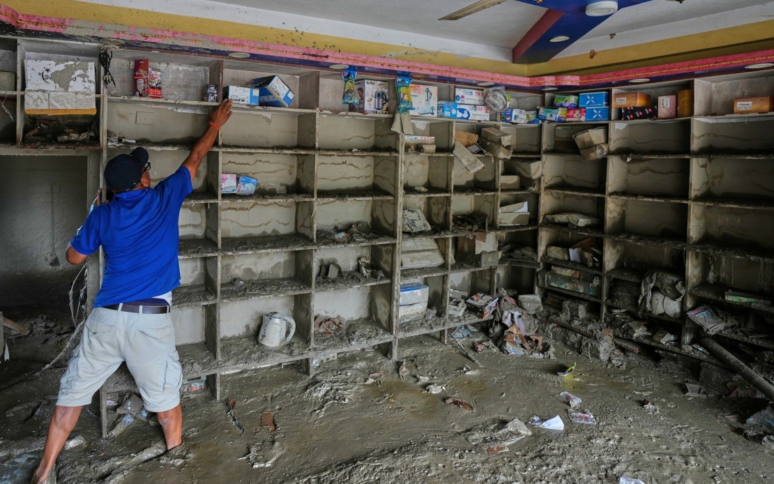
The impact zone proved devastatingly comprehensive. The mudslide flattened approximately 0.7 square kilometres of infrastructure and landscape, obliterating 27 structures and associated facilities in the Gyirong Port area. The death toll and missing persons figures represent the human dimension of this geological catastrophe. By Saturday evening, local authorities confirmed 16 confirmed fatalities, with 546 individuals unaccounted for, suggesting the potential for considerably higher final casualty figures. The missing persons count reflects both the violence of the initial impact and the practical difficulties faced by rescue teams in accessing and searching a severely damaged mountainous terrain.
The identification of this event's cause demonstrates the sophisticated monitoring and analytical capabilities now deployed to understand mountain disasters. The cryosphere emergency disaster response team conducting the investigation employed a multi-faceted approach, integrating remote-sensing satellite data with field-transmitted monitoring information and extensive on-site surveys. This combination of technological and observational methods allowed researchers to reconstruct the precise mechanics of the failure and track the debris flow's devastating path across the landscape. Such detailed analysis provides crucial information for understanding how similar events might unfold in the future.
The Gyirong Port incident carries particular significance for Southeast Asian and South Asian countries with high-mountain terrain. The Himalayan range hosts numerous glaciers feeding major river systems that sustain billions of people downstream across the Indian subcontinent, Southeast Asia, and southern China. Glacial lake outburst floods, debris flows, and avalanche-triggered mudslides represent an evolving hazard category that crosses international boundaries with indifference to political arrangements. The incident illustrates how environmental crises in one jurisdiction can produce immediate and severe consequences for neighbouring regions, a reality demanding enhanced transnational cooperation on mountain hazard monitoring and disaster preparedness.
Climate change introduces additional complexity to glacial stability across the Himalayas. Accelerating temperatures are destabilizing ancient ice masses that have remained relatively static for centuries, creating new failure mechanisms and increasing the frequency of catastrophic release events. Glaciers that anchored mountainsides for generations are retreating and weakening, exposing steeper terrain and reducing the mechanical stabilization previously provided by accumulated ice. The Mount Langtang Lirung failure exemplifies this pattern, occurring in a region where scientists have documented substantial glacial retreat over recent decades.
The Gyirong Port disaster also highlights the vulnerability of settlement patterns in high-mountain regions. Commercial facilities and transportation infrastructure concentrated in valley bottoms and river corridors occupy precisely those locations most exposed to debris flows and mudslides emanating from higher elevations. While engineers have developed sophisticated protective measures including retention barriers and drainage systems, communities located directly downslope from potentially unstable glaciers face inherent exposure that cannot be fully eliminated through structural means. Emergency planning and early warning systems therefore assume critical importance.
Regional cooperation on mountain hazard monitoring could significantly improve preparedness and response capabilities across the Hindu Kush-Himalayan range. Nepal and China, through their respective scientific institutions and governmental agencies, maintain significant expertise in glacial processes and mountain hazards. Formalized data sharing, joint monitoring programmes, and coordinated early warning systems could provide neighbouring communities with crucial advance notice of developing instability. The Gyirong Port incident demonstrates that such cooperation serves not merely academic interests but pressing humanitarian imperatives.
For Malaysia and Southeast Asia more broadly, the Gyirong Port catastrophe offers important lessons regarding infrastructure resilience and hazard mitigation in mountainous terrain. While the region's primary mountain ranges lack the extensive glaciation affecting the Himalayas, they remain subject to debris flows, landslides, and flash flooding triggered by extreme rainfall events. The scientific methodologies employed to investigate the Mount Langtang Lirung failure—integrating satellite monitoring, field data, and on-site investigation—provide applicable frameworks for understanding mountain hazards across diverse geographic contexts. Investment in such monitoring capacity and analytical expertise represents sound disaster risk reduction strategy.
The full scope of the Gyirong Port disaster will become clearer as rescue operations conclude and investigation teams complete their detailed analysis. However, the preliminary findings underscore the tremendous power wielded by natural processes in high-mountain environments and the substantial vulnerability of human settlements positioned downslope from active glacial terrain. As climate change continues accelerating glacial retreat globally, similar events may become increasingly frequent in the world's major mountain ranges, making robust scientific understanding and international cooperation essential components of effective disaster risk management.

