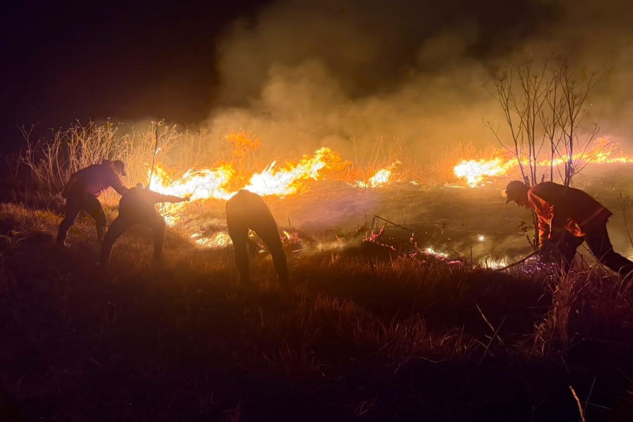
Indonesia's Mount Bromo continues to burn out of control as the disaster expands dramatically across East Java's most iconic volcanic landscape. The wildfire now covers roughly 520 hectares, having surged overnight Saturday into Sunday as meteorological conditions worsened the firefighting situation. The combination of powerful wind gusts funnelling down the mountain's terrain and exceptionally dry vegetation has created a perfect storm for rapid fire progression, transforming what might have been a contained incident into a spreading environmental crisis affecting one of the nation's premier natural attractions.
According to Bromo Tengger Semeru National Park (TNBTS) Authority head Rudijanta Tjahja Nugraha, the situation deteriorated sharply when the fire reignited Saturday evening. What initially appeared under control suddenly expanded across both the upper mountain slopes and down into the savanna plains that characterise the lower elevations. The directional spread pattern reveals how meteorological factors are dictating the fire's behaviour—strong winds arriving from the afternoon onwards provided sustained thrust, pushing flames from higher altitudes progressively downslope with mounting velocity and intensity. This downslope progression presents particular challenges for firefighting teams, who must work against natural wind patterns that actively feed oxygen to the advancing flames.
The underlying vulnerability stems from the region's current drought conditions. Grass cover and other vegetation across Mount Bromo's slopes and surrounding savanna have become critically desiccated following extended dry weather. This parched state transforms what would normally be moist or damp plant material into highly combustible fuel. The national park's elevation variations mean that different zones experience different moisture retention—higher slopes tend to be more exposed and thus drier, while lower savanna areas typically retain somewhat more moisture. Yet across all elevations, current conditions have created what fire specialists call extreme fire behaviour potential, where flames spread rapidly and intensely across otherwise varied terrain.
The scale of the affected area underscores the seriousness of the situation. Five hundred and twenty hectares represents a substantial portion of the national park's carefully managed ecosystems. For Malaysian readers familiar with national parks like Taman Negara, this scale becomes comprehensible—it encompasses the kind of landscape that would require years of careful restoration work. The Mount Bromo ecosystem supports distinctive highland savanna vegetation that has evolved specifically for volcanic soil conditions and elevation-dependent climate patterns. Uncontrolled fire destroys this carefully balanced environmental system, potentially creating erosion problems that may take decades to remediate naturally.
Responseses from park authorities have focused on immediate visitor safety and operational concerns. Bromo Tengger Semeru National Park implemented a full closure to tourists beginning at 10 pm Saturday, shutting all entrance points to the facility. This precautionary measure addresses both direct safety risks from the advancing flames and smoke inhalation dangers, but also acknowledges that emergency personnel require unobstructed access across the park for firefighting operations. Visitor management protocols included offering affected tourists the choice between rescheduling their trips or receiving full refunds—an economically significant concession that reflects the uncertainty about when normal operations might resume. The closure timeline remains indefinite, suggesting authorities harbour genuine concern about the fire's trajectory and potential for further expansion.
Investigation into fire origins has fallen under law enforcement jurisdiction, with Forestry Minister Raja Juli Antoni emphasising that deliberate forest and land burning constitutes a serious criminal offence. The minister's comments reflect growing national concern about repeat wildfire incidents and the legal framework designed to deter intentional fire-setting. The TNBTS Authority previously indicated that human activity was the suspected cause, meaning the blaze likely resulted from either negligent behaviour or intentional arson rather than natural phenomena. This investigative finding carries implications for prosecutions and subsequent deterrent messaging across Indonesia's tourism and forestry sectors.
The Mount Bromo incident must be understood within Indonesia's broader wildfire history. The nation experiences recurring fire crises, particularly during El Niño years when regional drought intensifies. East Java's Mount Bromo holds special significance as a major tourism destination drawing international visitors to experience Indonesia's volcanic geology and cultural heritage. Wildfires that damage such prominent natural sites generate ripple effects across the tourism economy, affecting guides, accommodation providers, transport operators, and countless adjacent businesses. For Southeast Asian tourism more broadly, any significant disruption at marquee destinations raises concerns about regional travel patterns and reputation.
The weather dimension deserves particular attention, as wind conditions will determine whether firefighting efforts can gain ground or face continued setbacks. Fire management in mountainous terrain depends critically on atmospheric stability—erratic wind patterns or sustained strong gusts can overwhelm even well-resourced firefighting operations. Indonesian fire management agencies must balance deploying sufficient personnel and equipment against the reality that adverse conditions can render such efforts largely ineffective. The strategic calculation involves whether to concentrate efforts on preventing fire spread into unburned areas or attempt active suppression across the current burn zone. Given the savanna's dry condition and ongoing wind activity, containment likely represents a more realistic near-term objective than active extinguishing across the entire 520-hectare perimeter.

