Japan's meteorological authorities issued an urgent alert on Friday as the nation prepared for a weekend weather crisis involving two converging typhoon systems, Higos and Mekkhala, each posing distinct hazards across different regions. The Japan Meteorological Agency cautioned that Typhoon Higos could make landfall from the Pacific on Saturday, while simultaneously tracking Mekkhala's approach toward the Amami region in southwestern Kagoshima Prefecture and its potential trajectory toward the eastern Kanto region. The compound threat represents a significant operational challenge for disaster management, as both systems are expected to trigger dangerous rainfall and storm surge across multiple population centers.
The precautionary scale of Japan's response underscores the severity of the forecast. By 7 am on Friday local time, the Fire and Disaster Management Agency had issued evacuation orders affecting more than 2 million people distributed across 13 prefectures spanning the Kinki and Kyushu regions. This represents one of Japan's most extensive pre-storm evacuations, reflecting the nation's experience-based approach to typhoon preparedness. In Seika, Kyoto Prefecture, authorities escalated emergency protocols to the highest level 5 safety alert after a landslide occurred during the morning hours, signaling that ground saturation had already reached critical thresholds.
The rainfall patterns documented over the preceding days reveal just how saturated the landscape had become before the typhoons' arrival. Between Tuesday and Friday morning, the Goto area in Nagasaki Prefecture recorded 600 millimetres of accumulated rain, while Aso in Kumamoto Prefecture and Ureshino in Saga Prefecture each measured over 500 millimetres. These figures substantially exceed normal precipitation and create conditions where soil stability becomes compromised, particularly on slopes and in mountainous terrain common throughout Japan's western regions. Such pre-event saturation effectively primed the landscape for additional landslide activity once the typhoon systems deliver their concentrated rainfall.
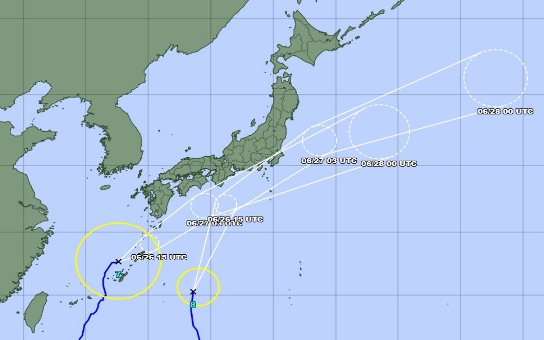
The dual-system aspect of this weather event complicates forecasting and resource allocation for Japan's disaster response apparatus. Typhoon Mekkhala, positioned northeast of Okinawa's Kume Island and moving at 15 kilometres per hour as of Friday mid-morning, represented an immediate concern for the southernmost prefecture. However, Typhoon Higos, approaching from the Pacific, posed the more significant threat to the densely populated central regions. The Japan Meteorological Agency anticipated that as Higos moves northward along Japan's southern coast, rainfall would intensify dramatically across the Tokai and Kanto regions—areas that include Tokyo and its surrounding prefectures, home to nearly 40 million people.
Rainfall projections for the critical Saturday period illustrated the magnitude of anticipated precipitation. The Tokai region, spanning central Japan's Pacific coast, was forecast to receive up to 300 millimetres by noon Saturday alone. The Kanto-Koshin region, encompassing the greater Tokyo area and surrounding mountainous zones, faced predictions of 150 millimetres. While the Kanto forecast appeared less severe than Tokai's, the region's already-stressed drainage systems and the proximity of these projections to major urban centers elevated the risk profile considerably. Cumulative rainfall when combined with Typhoon Mekkhala's concurrent approach would create compounding water management challenges.
Japan's meteorological agencies recognized that both typhoon systems would likely weaken into extratropical cyclones upon making landfall, a typical pattern as tropical systems encounter cooler mid-latitude air masses and lose their heat-driven energy. However, this transition from tropical cyclone to extratropical system does not necessarily eliminate danger; extratropical cyclones can produce prolonged rainfall and severe wind events over broader geographic areas. The agencies therefore maintained heightened alert levels and urged the public to remain vigilant regarding secondary hazards beyond the initial storm period.
The specific warnings emphasized two primary disaster mechanisms: landslides and flooding. Landslides posed the most immediate threat in Japan's mountainous and hilly terrain, particularly where recent construction has altered slope stability or where previous rainstorms had already destabilized soil. Flooding threatened lower-lying areas, urban drainage systems, and communities adjacent to rivers. Both hazards could persist for days as saturated ground conditions prevented rapid drainage and as rivers remained swollen above normal levels. Emergency services had pre-positioned resources and personnel in anticipation of surge demands for rescue operations and humanitarian assistance.
For Southeast Asian readers, Japan's typhoon situation carries broader regional significance. The broader Western Pacific typhoon season affects weather patterns across Southeast Asia, and the intensity of systems forming near Japan can sometimes influence conditions further south. Additionally, Japan's sophisticated early warning systems and evacuation protocols offer instructive models for developing nations in Southeast Asia that face similar typhoon risks but with less developed infrastructure for mass evacuation and disaster communication. The scale of Japan's response—evacuating over 2 million people preemptively—reflects both the nation's risk awareness and its economic capacity to implement such measures.
The weekend forecast would determine whether these precautions proved proportionate or excessive. If both typhoons followed predicted northeastward tracks and weakened as anticipated, the evacuations might appear overly cautious in hindsight. Conversely, if either system stalled, intensified, or shifted course unexpectedly, the advance preparations would have proven invaluable. Japan's meteorological and disaster management agencies, operating within a framework refined through decades of typhoon experience and recent technological improvements in forecasting, had positioned the nation to respond rapidly to developments that would emerge over the following 48 hours.