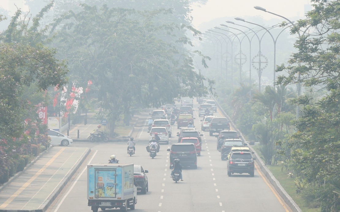
Indonesia faces a severe air quality crisis as forest and peatland fires intensify across Sumatra and Kalimantan, with pollution readings reaching dangerous levels that threaten public health and regional air quality. The Air Pollutant Index surged to 573 in Jekan Raya, a subdistrict within Palangka Raya in Central Kalimantan, based on monitoring conducted across 17 air-quality stations as of early Wednesday morning. This hazardous classification represents the most severe category on Indonesia's pollution scale, indicating conditions where all segments of the population face significant health risks from continued outdoor exposure.
The pollution extends far beyond Central Kalimantan's worst-hit areas. Muaro Jambi Regency in Jambi Province recorded a similarly dangerous API reading of 302, joining Jekan Raya in the hazardous category. Meanwhile, multiple locations across the archipelago registered very unhealthy air quality levels ranging between 201 and 300, including Pelalawan in Riau, both Penukal Abab Lematang Ilir and Ogan Ilir in South Sumatra, Southeast Pontianak in West Kalimantan, and Gunung Mas and Katingan in Central Kalimantan. This geographic spread demonstrates how smoke from peatland fires blankets vast areas, crossing provincial boundaries and creating a transnational haze that threatens millions across the Sunda Strait region.
According to Then Suyanti, the Health Ministry's Environmental Health Director, authorities are issuing urgent public health guidance for affected populations. In areas classified as hazardous, the ministry explicitly recommends that all residents avoid outdoor activities entirely, recognising that even brief exposure poses unacceptable health risks. For regions experiencing very unhealthy air conditions, officials advise against prolonged outdoor stays, particularly cautioning vulnerable populations including children, the elderly, and those with respiratory conditions. The ministry is preparing a comprehensive circular, expected to be released within two days by the secretary-general, establishing emergency protocols including the authorisation for schools to transition to distance learning when air quality deteriorates beyond acceptable thresholds.
The humanitarian impact of these fires extends across a staggering geographic footprint. The Health Crisis Centre reports that approximately 3.4 million people across seven provinces have been directly affected by the disaster. These provinces—Riau, Jambi, and South Sumatra on Sumatra island, alongside West, Central, East, and South Kalimantan on Borneo—have collectively declared emergency alert status, though not yet the maximum emergency response designation. This measured response reflects cautious optimism that intensified firefighting operations may contain the fires before conditions deteriorate further. The authorities have mobilised 321 health personnel throughout the affected provinces to manage medical responses and monitor health impacts.
Casuality numbers remain relatively low but concerning. Thus far, 42 individuals have suffered minor injuries directly attributable to fires, whilst two severely burned victims in South Kalimantan require hospital treatment. Notably, no deaths have been reported and evacuations remain unnecessary at present, suggesting that whilst air quality poses severe public health risks through respiratory exposure, the fires have not yet forced mass population displacement. However, the situation remains precarious, with continuing fire spread potentially shifting this equation rapidly.
Satellite monitoring reveals the ongoing threat landscape remains formidable and deteriorating. Indonesia's Forestry Ministry detected 805 high-confidence hotspots and 11,313 medium-confidence hotspots across the nation as of Tuesday evening. Among six priority provinces designated for intensive intervention, South Sumatra leads with 239 confirmed hotspots, followed by Central Kalimantan with 113, South Kalimantan with 89, and West Kalimantan with 86. Jambi and Riau recorded only seven and one high-confidence hotspots respectively, though medium-confidence readings—fires not yet conclusively confirmed—remain substantial. West Kalimantan shows 2,447 medium-confidence hotspots, Central Kalimantan 2,168, South Sumatra 1,161, South Kalimantan 710, with Riau and Jambi recording 199 and 197 respectively.
For Malaysia and broader Southeast Asia, this crisis carries immediate implications. Transboundary haze from Indonesian fires has historically affected Malaysian air quality, particularly in Peninsular Malaysia's east coast and Sarawak. The current scale of fires suggests similar cross-border smoke drift could emerge if current trends persist, potentially replicating the severe haze episodes that plagued the region in previous years. Malaysian authorities typically monitor Indonesian fire hotspots and air quality data to anticipate haze episodes and issue public health advisories accordingly. The current readings exceed even dangerous thresholds, indicating substantial smoke volume potentially available for regional dispersion depending on meteorological patterns and wind directions.
The root cause of these fires remains linked to Indonesia's vulnerable peatland ecosystems. Peat fires burn differently than conventional forest fires—they smoulder extensively, producing disproportionate smoke volumes relative to visible flames. This characteristic explains why air pollution readings reach extreme levels even when fires do not immediately threaten populated centres. Peatlands store vast carbon quantities and release them during combustion, compounding both air quality degradation and climate impacts. The seasonal transition period typically intensifies fire risk as dry seasons progress, though human activities including land clearing and agricultural preparation accelerate fire occurrence and spread.
Indonesian government response mechanisms operate within resource constraints that frequently hamper effectiveness. The mobilisation of 321 health personnel across seven provinces, whilst substantial, represents a thin distribution across territories encompassing millions of residents. Firefighting capacity, whether through ground crews or aerial support, often proves insufficient to contain simultaneous fires across such expansive areas. The declaration of emergency alert status rather than maximum emergency response reflects a decision to conserve resources for potential escalation, though critics argue such measured responses sometimes delay decisive action that could prevent situations from reaching crisis proportions.
The international dimension adds complexity to response efforts. Whilst Indonesia bears primary responsibility for domestic fire management and air quality protection, neighbouring countries including Malaysia, Singapore, and Brunei sustain collateral impacts. Regional cooperation frameworks, including the ASEAN Agreement on Transboundary Haze Pollution, theoretically provide coordination mechanisms, yet implementation challenges persist. Information sharing improves, but coordinated prevention efforts remain limited by each nation's sovereignty and domestic resource availability. The recurring nature of these crises—occurring cyclically across dry seasons—suggests that without systematic peatland protection and improved land management practices, the region faces continued vulnerability to severe air pollution episodes.
Looking forward, the trajectory remains uncertain. Authorities hope that intensified firefighting efforts will gradually suppress active fires and reduce smoke generation, though weather patterns and seasonal progression will ultimately determine fire behaviour. The situation demonstrates Indonesia's ongoing struggle to balance economic development pressures on peatland-rich regions with environmental protection imperative. For Malaysian observers, the current crisis underscores the region's interconnected environmental vulnerabilities and the importance of maintaining cross-border monitoring and preparedness systems capable of responding to transnational environmental challenges that transcend political boundaries.

